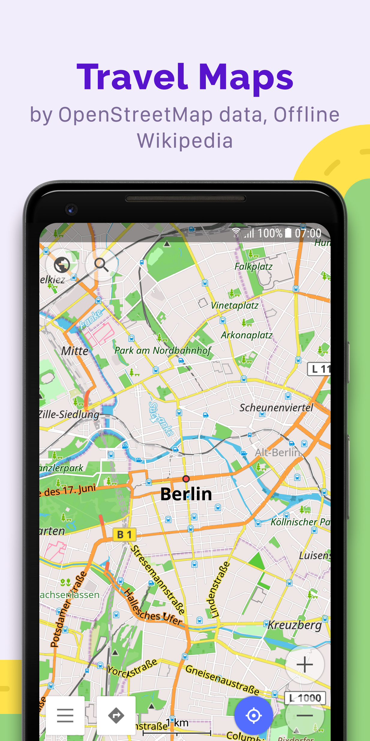
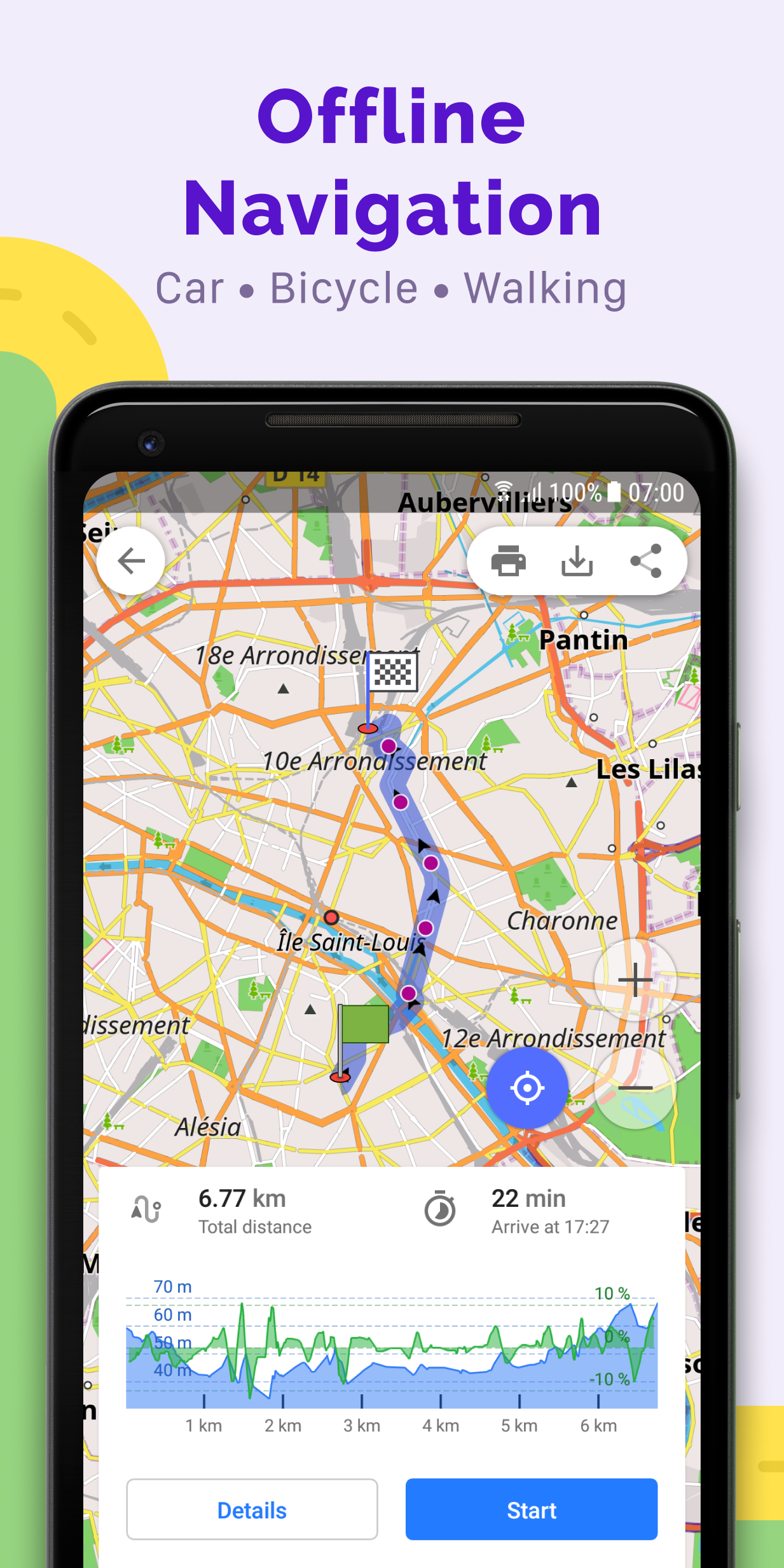
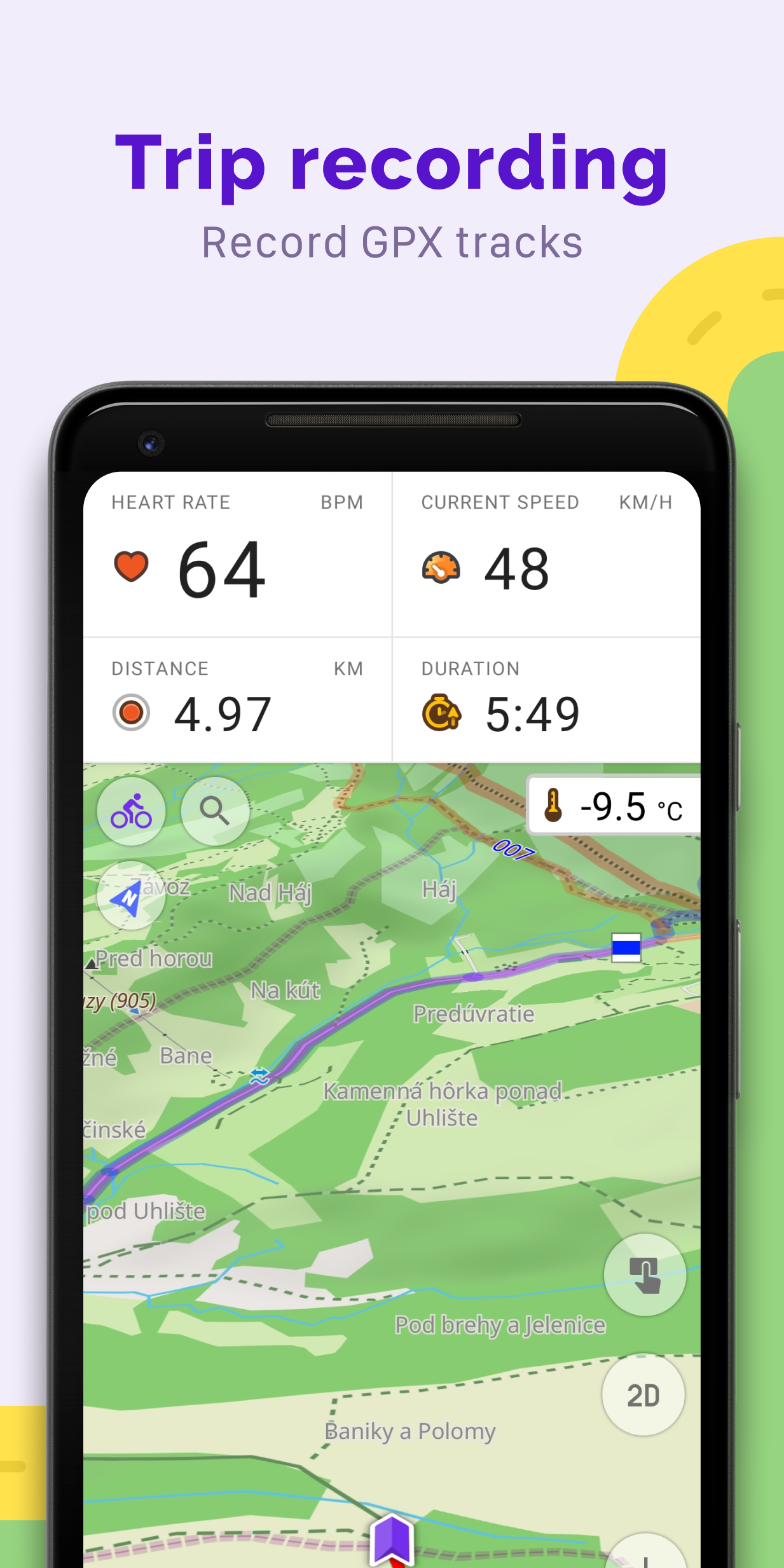
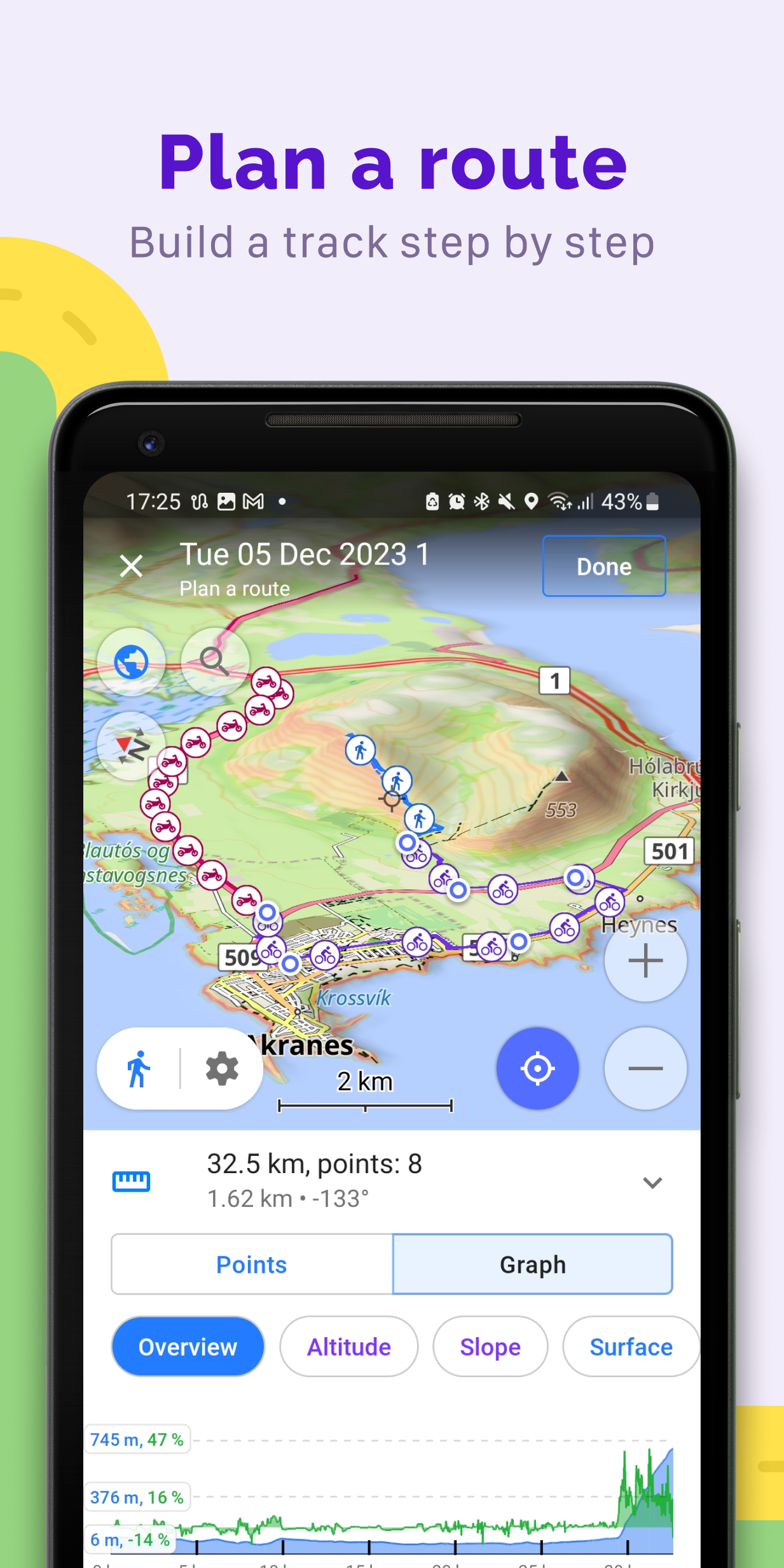
OsmAnd — Maps & GPS Offline
8.8 18K+
v4.7.10 by OsmAnd


Requires Android: Android 6.0+
Architecture: arm64-v8a
Screen DPI: 160-640dpi
SHA1: ba450fb04ce97515af4c5d324d5c7552e6e8586e
Size: 192.09 MB
What's New:
Requires Android: Android 6.0+
Architecture: arm64-v8a, armeabi-v7a, x86, x86_64
Screen DPI: 120-640dpi
SHA1: 4e7d3d08acb1130d6776dc0a5eec62f77bce9f42
Size: 329.47 MB
What's New:
Package Name:
Category:
Update Date:
2024-04-22
Latest Version:
4.7.10
Need Update:
Available on:
Requirements:
Android 6.0+
Report:
ViaMichelin GPS, Maps, Traffic
GPS Navigation, Routes, Traffic Information, Danger Zones, Enhanced Map
7.3 5K+
Karta GPS Offline Maps Nav
Live Traffic; Speed Radar information; Route Planner; Parking & Directions
8.9 7K+
ATAK-CIV (Civil Use)
The Android Team Awareness Kit is a geospatial & situational awareness platform.
6.0 82
Genius Maps Car GPS Navigation
Offline GPS navigation with free professional maps and POI.
7.0 1K+
komoot - hike, bike & run
Discover new routes, plan hikes, rides & runs, and navigate your adventures.
8.6 32K+
Yandex Navigator
Yandex Navigator helps you find the best routes through traffic.
9.1 201K+
FieldBee tractor navigation
Professional tractor navigation, steering and precision agriculture app
8.6 151
Google Maps
Real-time GPS navigation & local suggestions for food, events, & activities
8.1 1M+
Yandex Maps and Navigator
Search organizations, get directions, traffic & transport info, use maps offline
8.9 90K+
Parking Plugin — OsmAnd
Parking plugin is a reminder for your parking position
8.6 174
Nautical Charts — OsmAnd
OsmAnd Nautical Charts is a plugin that provides Nautical Maps
7.4 145
Ski Map Plugin — OsmAnd
Ski Map plugin for OsmAnd Maps & Navigation
8.8 79
OsmAnd+ — Maps & GPS Offline
Navigation on hikes is no longer a problem. Download the map, put notes and go!
9.3 3K+
Contour lines plugin — OsmAnd
Contour lines & Hillshade for OsmAnd Maps (SRTM, ASTER, NASA)
8.0 178
OsmAnd API Demo
Allows you to test integration with OsmAnd and functioning of the main features.
5
